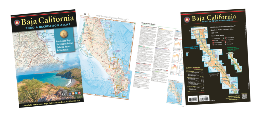
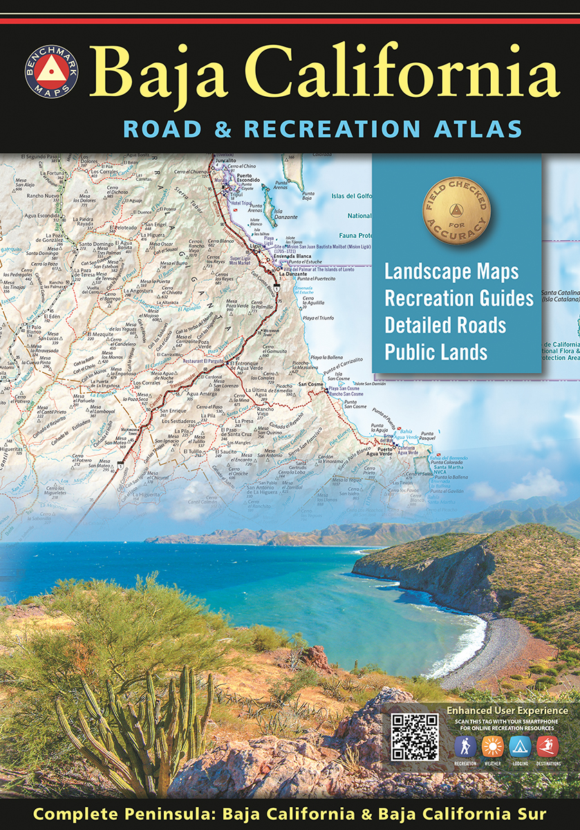
There’s a new Baja Atlas available and we’re so excited for you to have this invaluable tool for your Baja explorations! The Baja California Road & Recreation Atlas is a gorgeous full-color, large-format atlas that covers the entire peninsula with detailed maps as well as recreation guides that highlight campgrounds, parks, natural wonders, beaches, historical sites, and more.
 The atlas is published by Benchmark Maps, a company with a crew of award-winning cartographers who have been driving and mapping the American West, publishing award-winning recreation maps and atlases since 1995. Their precise and easy-to-use atlases are essential tools for planning and navigating road trips and adventures, which has earned them a loyal customer base of discriminating map users who appreciate Benchmark Maps’ expertise in mapping public lands and back roads.
David Kier (Baja aficionado and author of Baja California Land of Missions) assisted with editing the atlas and brought his Baja expertise and attention to detail to the project. He had the following to say about the project:
“Since the passing of Landon Crumpton, publisher of the Baja California Almanac, those of us who love traveling and exploring the peninsula became aware of the need for an updated set of maps. Twelve years after the final Baja Almanac was published, Benchmark Maps has stepped forward to fill the void. Their large, atlas map books of the Western United States are well-known in the travel and outdoor recreation world.
A year ago, I was contacted by Benchmark Maps to provide some input into this new project. I had traveled so much of the peninsula and recorded road details which I have shared on my website, VivaBaja.com. As it turned out, there was much I could offer in checking road conditions, place names, and the mission history. We also added the historic El Camino Real routes from Loreto to El Rosario. This was possible thanks to the ground research done by CaminoRealBaja.com. The Baja Divide bicycle route is also well-illustrated on these new maps. A big plus is that each road with kilometer posts also has those points shown on the new maps, a great aid in navigation or trip planning.
Because conditions change, it is refreshing to learn that Benchmark plans on future editions of the new Atlas and they encourage readers to submit updates or corrections to help make their maps the most accurate as possible. I really appreciate knowing that! The new maps are beautiful, crisp, and up to date for the Baja California traveler or armchair adventurer.”
About the Baja California Road & Recreation Atlas:
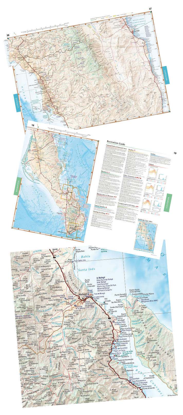
The first edition Baja California Road & Recreation Atlas showcases the diverse recreation opportunities found along the full length of the Baja California Peninsula. Regional maps provide a wider view of the region and Recreation Guides list an array of attractions for trip planning. Landscape Maps™ provide the most detail, bringing the peninsula’s rugged terrain into focus with land cover data, shaded relief, and a detailed road network to aid travelers navigating between cities or seeking remote destinations. From Tijuana to Land’s End, this is the best recreation map product on the market.
Landscape Maps™
- Large scale maps with detailed road classifications, points-of-interest, landmarks, elevations
- Kilometer markers on major highways
- Page-to-page map overlap, clear legibility
- National Parks and Wildlife Areas
Recreation Guides
- Regional maps at medium scale illustrate broader views and longer routes
- Focused maps & listings for La Paz, Los Cabos Corridor, and wineries of Valle de Guadalupe
- Recreation categories include:
- Parks, Monuments, Natural Wonders
- Boating & Fishing Access, Beaches
- Historic Missions & Ruins
- Campgrounds & RV Parks
The Baja California Road & Recreation Atlas is available for sale to Discover Baja members for $26 + shipping. Order yours online now! You can also call the Discover Baja office at 1-800-727-2252 to place your order.
Excellent news!
HI
Looking forward to the maps. will they have Long/Lat coordinates on each page?
Hi, does the new atlas provide information/details on the” long awaited constructed road (5) down past San Felipe adjoining
meeting Highway (1)? Gas stations .
Thankyou.
Yes, we want one of these.
Yes but would like to order one when it’s available.
I’ll take one. Thank you.
YES!!! HOW EXCITING!!!